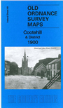
Ireland Sheet 69 Cootehill & District 1900 - published 2014; intro by Alan Godfrey. ISBN.978-1-84784-781-2
This Inch to the Mile map covers the the area around Cootehill, including parts of counties Cavan and Monaghan.
Features include Cootehill itself, for which a detailed map is also included on the reverse; Stradone, Drum, Shercock, Lough Sillan, Loughbawn House, Dartrey House, Clements Town,a section of the Cootehill railway branch,
etc.
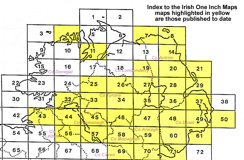
An index map is available showing the areas covered by the Inch to the Mile maps. Go to This Index Map.
For a full list of maps for One Inch maps for Ireland go to the Ireland Inch to the Mile page; or for other maps of Ireland visit the Ireland page.
You can order maps direct from our On-line Mapshop.
For other information and prices, and other areas, go to The Index Page.
Alan Godfrey Maps, Prospect Business Park, Leadgate, Consett, Co Durham, DH8 7PW / sales@alangodfreymaps.co.uk / 16 January 2018
 Here is information about Sheet 69: