 Here are the details of maps for Godmanchester:

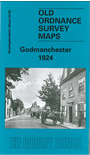
This detailed map covers most of the town of Godmanchester, with coverage extending eastward a mile to the Emmanuel Knoll Tree.
Features include Town Hall, town centre with individual buildings neatly shown, St Mary's church, Corpus Christi House, Old Mill Race, Chadleigh House, boat houses, etc. On the reverse we include a 1924 directory of Godmanchester.
The map links up with Huntingdon sheet 18.14 Huntingdon East to the north.
Follow this link for a complete list of our Huntingdonshire maps.
You can order maps direct from our On-line Mapshop. For other information and prices, and other areas, go to The Index Page.
Maps in the Godfrey Edition are taken from the 25 inch to the mile map and reduced to about 15 inches to the mile. For a full list of maps for England, return to the England page.
Alan Godfrey Maps, Prospect Business Park, Leadgate, Consett, Co Durham, DH8 7PW / sales@alangodfreymaps.co.uk / 28 June 2016