 Here are the details of maps for Ramsey:

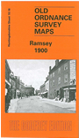
This detailed map of Ramsey is double-sided for maximum coverage. The main map covers the centre of the town, with coverage eastward to Cook's Lane. Features include St Thomas a Becket's church, Ramsey Abbey, Booth's Hill, Great Whyte, chapels, town centre with individual buildings neatly shown, Northey Farm, Church Green, cemetery etc.
On the reverse we include part of adjacent sheet 10.15 covering the western part of the town. Features here include Britainnia Iron Works (disused), GN&GE Joint station, GER station (at top of map), The Field, Field Foundry.
Follow this link for a complete list of our Huntingdonshire Series maps.
You can order maps direct from our On-line Mapshop. For other information and prices, and other areas, go to The Index Page.
Maps in the Godfrey Edition are taken from the 25 inch to the mile map and reduced to about 15 inches to the mile. For a full list of maps for England, return to the England page.
Alan Godfrey Maps, Prospect Business Park, Leadgate, Consett, Co Durham, DH8 7PW / sales@alangodfreymaps.co.uk / 28 July 2010