Old Ordnance Survey Maps of Hull

  • For the central area of Hull we have reprinted four of the very early Five-foot plans, here reduced in scale to 1:1760 or a Yard to the Mile. The maps, though covering quite a small area, are extremely detailed, showing such features as capstans and mooring posts, lamp-posts, the layouts of back yards, and even the interior of certain public buildings. They are available through our On-line Mapshop

  • Here are the details of the map for the Railway Dock area:

  • Kingston upon Hull: sheet 11 Hull (Railway Dock & Paragon Station) 1853 - published 2008; intro by Susan Neave. ISBN.978-1-84784-100-1

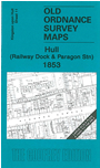
    This wonderfully detailed map covers the area from Railway Dock northward to Paragon station, and westward to Wellington Lane. It shows tremendous detail, even including outhouses and garden paths. Paragon station is shown and other features include Master Mariners Alms Houses, Queen's Theatre, Great Thornton St Chapel, Trinity Chapel, St John's church, Julian Spring Brewery, and the warehouses around Railway Dock. On the reverse we include street directory entries for Adelaide Street, Anlaby Road, Cogan Street, Osborne Street, Paragon Street.

    The map links up with Sheets 7 Hull Prospect Street to the north and 12 Hull Old Town to the east.


  • You can order maps direct from our On-line Mapshop. For other information and prices, and other areas, go to The Index Page.
  • The town plans are taken from the OS five-foot plans and reduced to a scale of a yard to the mile. Follow this link for a complete list of our Hull maps or all the Yorkshire maps.
    Alan Godfrey Maps, Prospect Business Park, Leadgate, Consett, Co Durham, DH8 7PW / sales@alangodfreymaps.co.uk / 20 Sept 2016