Old Ordnance Survey Maps of Hertfordshire

  • These detailed maps normally cover an area of about one and a half miles by one mile. Each map includes an introduction.
  • They are available through our On-line Mapshop

  • Here are the details of maps for Hemel Hempstead (S):

  • Hertfordshire Sheet 33.12 Hemel Hempstead (South) 1897 - published 1990; intro by Eve Davis. ISBN.978-1-84151-813-8

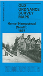
    This detailed map covers the southern part of Hemel, including the Paradise, Moor End, Cornerhall areas. Two Waters and Manor Farm is at the foot of the map. Features include Camden House, a stretch of the MR Hemel Hempstead Branch, Boxmoor Iron Works, West Herts Infirmary, River Gade, Grand Junction Canal, Bennett's End, Tilekiln Farm etc.

    On the reverse we include an early Inch to the Mile map, covering the area from Aylesbury eastward to Redbourn.

    The map links up with sheet 33.08 Hemel Hempstead to the north and 33.11 Boxmoor to the west.


  • Follow this link for a complete list of our Hertfordshire Series maps or go to the Chilterns page for other counties in the region.
  • You can order maps direct from our On-line Mapshop. For other information and prices, and other areas, go to The Index Page
  • Maps in the Godfrey Edition are taken from the 25 inch to the mile map and reduced to about 15 inches to the mile. For a full list of maps for England, return to the England page.
    The Godfrey Edition / sales@alangodfreymaps.co.uk / 28 January 2018