
 Here are the details of maps for Tetbury:

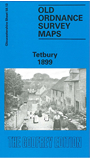
This detailed map covers the small south Cotswolds town of Tetbury. Most of the town is covered and features include St Mary's church, Market Place, The Chipping, Cutwell, cattle market, station with track layout and engine shed, The Knapp, cottage hospital, Long Street, St Saviour's church, brewery. Coverage extends north to Retreat House, west to Charlton House. A contemporary directory is included on the reverse.
Maps in the Godfrey Edition are taken from the 25 inch to the mile map and reduced to about 15 inches to the mile. For a full list of maps for England, return to the England page.
Alan Godfrey Maps, Prospect Business Park, Leadgate, Consett, Co Durham, DH8 7PW / sales@alangodfreymaps.co.uk / 28 October 2016