
 Here are the details of maps for Gloucester SE:

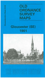
This detailed map covers the SE area of Gloucester, with coverage stretching from Seymour Road and Spa Field eastward to Coney Hill, and from Park Road southward to Linden Road. The western two-thirds of the map is largely residential including Barton and Lower Barton Wards. Features include the GWR Gloucester Branch, with Cheltenham South Junction; the Midland Railway Bristol & Birmingham line; cemetery, Saint Bridge, Chequer's Bridge, St James church, Emlyn Foundry & Engineering Works, tramways and depot, Tredworth, infectious diseases hospital, MR High Orchard Branch, The Park, etc. On the reverse we include a selection of street directory entries, incl Alfred Street, Barton Street, Brunswick Square, Park Road.
The map links up with Gloucs sheet 25.15 City of Gloucester to the north and 33.02 Gloucester SW to the west.
Maps in the Godfrey Edition are taken from the 25 inch to the mile map and reduced to about 15 inches to the mile. For a full list of maps for England, return to the England page.
Alan Godfrey Maps, Prospect Business Park, Leadgate, Consett, Co Durham, DH8 7PW / sales@alangodfreymaps.co.uk / 28 October 2016