
 Here are the details of maps for Moreton-in-Marsh:

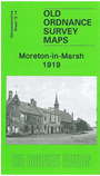
This detailed map provides good coverage of Moreton-in-Marsh, with coverage stretching east to Wellington Terrace. Features include the town centre, St David's church, The Green, Britannia engineering works, cemetery, Town Hall, High Street, station creamery. On the reverse we include a directory of Moreton in 1894, together with a timetable for the Shipston-on-Stour branch.
Maps in the Godfrey Edition are taken from the 25 inch to the mile map and reduced to about 15 inches to the mile. For a full list of maps for England, return to the England page.
Alan Godfrey Maps, Prospect Business Park, Leadgate, Consett, Co Durham, DH8 7PW / sales@alangodfreymaps.co.uk / 28 October 2016