
 Here are the details of maps for Port Talbot:

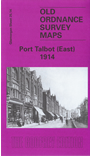
This detailed map covers much of Port Talbot, and links up with a companion map for Aberavon. It covers the area from Port Talbot station eastward to Goytre and Dyffryn-uchaf.
Features include part of town centre, with GWR station, Central Station, part of Station Road, Taibach Tin Plate Works, Ffrwdwyllt Tin Plate Works, St Theodore's church, Atheletic Ground, St Agnes church, short stretch of Rhondda & Swansea Bay Railway with engine shed, Major stretch of Port Talbot Railway with engine shed, Tan-y-groes Junctions, Holy Cross church, Dyffryn Junction, Dyffryn Mills, Margam Sanatorium etc.
The map links up with sheet 25.13 Aberavon to the west.