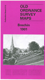
Forfarshire Sheet 27.13 Brechin 1901 - published 1992; intro by David G Adams. ISBN.978-1-84151-365-2 
This detailed map covers the centre of Brechin and the area to the south and west, with coverage stretching from Victoria Park westward and southward to Stannochy Bridge.
Features include Brechin Castle, churches, Meikle Mills, CR railway terminus, Poorhouse, River South Esk, Brechin Bridge, Valley Works, Den Burn Works, East Church, etc. We include some extracts from a trade directory on the reverse.
Follow this link for a complete list of our Angus & Dundee maps.
You can order maps direct from our On-line Mapshop.
For other information and prices, and other areas, go to The Index Page.
Maps in the Godfrey Edition are taken from the 25 inch to the mile map and reduced to about 15 inches to the mile.
For a full list of maps for Scotland, return to the Scotland page.
The Godfrey Edition / sales@alangodfreymaps.co.uk / 19 Nov 2016

 Here are the details of maps for Brechin: