
 Here are the details of maps for Buckley:

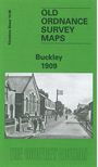
This detailed map of Buckley is double-sided for maximum coverage. The main map covers the area from Victoria Terrace and Brunswick Road westward to Bryn-y-bal and part of Mynydd-isa, and northward to Buckley Mountain. Features include South Buckley Brick Works with mineral railway and tramway, High Street area, The Square, Emmanuel church, Pren-Brigog, Wat's Dike, Willow Colliery (disused), Ewloe Pottery, Belmount Brick Works, Ewloe Place, old coal shafts, chapels, etc.
On the reverse we include part of adjacent sheet 14.09 extending coverage southward to include Padeswood & Buckley station and short stretch of LNWR Mold Branch, Bistre Farm, Nant-Mawr area, Garreg-lwyd.
The map links up with sheet 13.08 Mold to the west