
 Here are the details of maps for Leigh-on-Sea:

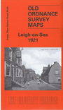
This detailed and very busy map covers Leigh-on-Sea, west of Southend. Coverage stretches from Sunningdale Avenue and King's Road westward to Herschell Road.
The many features include the railway with Leigh station, the old village centre, old saltings and fish ponds, Ship Hotel, Lapwater Hall, St Clement's church, tramway, Council Offices, Leigh Cliffs, St Michael's church, many schools, cinemas, chapels etc. Ian Yearsley's introduction gives a good description of Leigh's development from a village into a substantial town.
The map links up with sheets 91.01 Westcliff-on-Sea to the east.
Maps in the Godfrey Edition are taken from the 25 inch to the mile map and reduced to about 15 inches to the mile. For a full list of maps for England, return to the England page.
Alan Godfrey Maps, Prospect Business Park, Leadgate, Consett, Co Durham, DH8 7PW / sales@alangodfreymaps.co.uk / 18 June 2019