
 Here are the details of maps for Loughton:

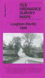
This detailed map covers much of the central and northern part of Loughton. Coverage stretches from St Mary's church northward to Arewater Green and Baldwin's Hill.
Features include Ash Green, Pump Hill, The Hole, Border's Farm, much of High Road, Albion Granaries, St John the Baptist church, Rectory Green, Marlcroft House, Trapshill Farm etc. On the reverse we include a list of private residents from an 1895 directory.
The map links up with Essex Sheet 57./16 Loughton South to the south
Maps in the Godfrey Edition are taken from the 25 inch to the mile map and reduced to about 15 inches to the mile. For a full list of maps for England, return to the England page.
Alan Godfrey Maps, Prospect Business Park, Leadgate, Consett, Co Durham, DH8 7PW / sales@alangodfreymaps.co.uk / 25 November 2017