
 Here are the details of maps for Braintree:

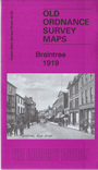
This detailed map gives good coverage of Braintree.
Features include town centre with individual buildings neatly shown, GER railway with station, goods station (ie former station), Chapel Hill, Buckwood Farm, Manor Works, St Michael's church, Braintree Union Workhouse, New Mills, Mount House, Braintree Silk Mills, Strawberry Hill Farm, etc. Extracts from 1922 directory are included on the reverse.
Maps in the Godfrey Edition are taken from the 25 inch to the mile map and reduced to about 15 inches to the mile. For a full list of maps for England, return to the England page.
Alan Godfrey Maps, Prospect Business Park, Leadgate, Consett, Co Durham, DH8 7PW / sales@alangodfreymaps.co.uk / 25 November 2017