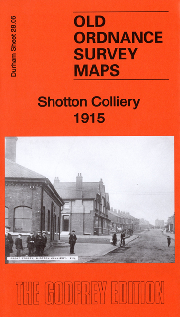
Co Durham Sheet 28.06 Shotton Colliery 1915 - published 2019; intro by Neil Gander. ISBN.978-1-78721-296-1 
This detailed map covers the mining village of Shotton Colliery.
Features include village with individual buildings neatly shown, Colliery with railway lines, Brick Works, St Saviour's church,
picture theatre, NER railway with Shotton Bridge station, Haswell Moor, etc
We include extracts from 1894 and 1906 directories, together with a specially written introduction.
Follow this link for a complete list of our Durham maps.
You can order maps direct from our On-line Mapshop.
For other information and prices, and other areas, go to The Index Page.
Maps in the Godfrey Edition are taken from the 25 inch to the mile map and reduced to about 15 inches to the mile.
For a full list of maps for the North East, return to the North East page.
The Godfrey Edition / sales@alangodfreymaps.co.uk / 20 December 2019
 Here are the details of maps for Shotton Colliery: