 Here are the details of maps for Seaham Harbour:

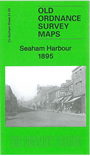
This detailed map of Seaham Harbour is double-sided for maximum coverage and includes both sheets 21.03, covering the western part of the town and New Seaham, and 21.04, which covers the harbour area.
Features on sheet 21.03 include St John's church, part of town centre, Londonderry Railway with Seaham Colliery and Seaham stations, Londonderry Engine Works, Wagon Works, Dene House, part of South Hetton Railway, Rainton & Seaham Railway including Seaham Bank incline, Dawdon Hall, Dawdon Dene, most of New Seaham, Seaham Colliery, Miners Hall, Colliery Inn, Brick Works etc.
Sheet 21.04 on the reverse shows the harbour incl North Dock, South Dock and Dry Harbour; Blastfurnace Branch railway, Ballast Branch, Seaham Bottle Works, Chemical Works (disused), Terrace Green, Bath Terrace (near top of map), Swine Lodge Bank and railways around docks, Bottle Makers Arms, etc. These are lovely busy maps with lots of industrial and railway information.