This is one of three maps being published for Duisburg, as companion to the Ruhrgebiet maps. It is taken from the British War Office plans, published in 1945, prior to the Allied occupation of the area, and is especially good at showing industry, collieries and transport. The maps are neatly folded
and each includes a specially written introduction to the area. Maps can be purchased on our
On-line Mapshop.
 Here are the details of our map of the Ruhrort area:
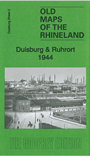
- 2 Duisburg & Ruhrort 1944 - published 2010. Introduction in English by Alan Godfrey; German summary by Heike Hamilton

This map covers the centre of Duisburg, Ruhrort, Laar and parts of Meiderich, Homberg and Beeck. Covers stretches from Duisburg Hauptbanhof northward to Beeck and westward to Hochheide.
Features include the various docks at Ruhrort, the largest inland port in Europe; the harbours at Duisburg; several collieries, the major steelworks at Laar, other industries on the west side of Duisburg, railways, Duissern, Papandell,
Meiderich, Laar, Kaddlerfeld, Neuenkamp, Ruhrort, Beeck, Homberg, Essenberg, Asterlagen, Hochheide, Hochhalen, River Rhein. An index names many of the factories and other large buildings.
You can order maps direct from our On-line Mapshop.
For a full list of maps for Germany and prices go to the Germany Page. For other information, see the Index Page.
Alan Godfrey Maps
Prospect Business Park
Leadgate, Consett, DH8 7PW
England
Tel. (01207) 583388 or Fax (01207) 583399
Return to Index
The Godfrey Edition / For orders and general enquiries: godfreyedition@btinternet.com / revised 26 July 2011