
 Here are the details of maps for Dublin Castle:

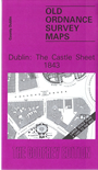
The Castle Sheet was one of the first town plans published by the Ordnance Survey in either Ireland or Britain. Originally drawn at a scale of five feet to one mile, it is a highly detailed overview, showing each street, house, the interior of public buildings, pumps, garden layouts, even individual trees. The Survey's manuscript town plans were not then intended for separate publication, but when this sheet was engraved using a machine invented at the Dublin OS by William Dalgeish, it was put on sale in 1840 largely for reasons of professional pride. One writer thought it 'the finest example of map engraving ever produced in the United Kingdom' and eventually the other 32 city sheets were also published. This reproduction, here reduced to a scale of three feet to the mile, is from a revised edition of 1843.
The Castle Sheet covers an area east of the medieval walled town. It includes many of Dublin's principal buildings and institutions, such as Dublin Castle, The Royal Exchange, the old Parliament House, Trinity College, the Royal Irish Academy and Mercer's Hospital. The Castle Sheet is both an evocative record of the city in 1843 and a tribute to the work of the Ordnance Survey.