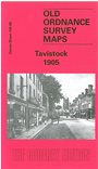
Devon Sheet 105.08 Tavistock 1905 - published 2003; intro by Tom Greeves. ISBN.978-1-84151-594-6 
This detailed map covers most of the town of Tavistock with coverage extending form Ford Street eastward to Taviton Mill.
Features include LSWR railway with station, GWR Launceston Branch with station, town centre with individual buildings neatly shown, New Market, Kelly College, Mount Tavy, Courtenay House, Town Mill, Bedford Square area, churches, chapels, Workhouse, The Meadows Pleasure Ground, Maynard's Charity, etc. On the reverse we include a 1906 commercial directory of Tavistock.
Follow this link for a list of our maps for Devon county, Plymouth,
or Torbay; or here for a general list for the South West.
You can order maps direct from our On-line Mapshop.
For other information and prices, and other areas, go to The Index Page.
Maps in the Godfrey Edition are taken from the 25 inch to the mile map and reduced to about 15 inches to the mile.
For a full list of maps for England, return to the England page.
Alan Godfrey Maps, Prospect Business Park, Leadgate, Consett, Co Durham, DH8 7PW /
sales@alangodfreymaps.co.uk / 13 January 2018

 Here are the details of maps for Tavistock: