Old Ordnance Survey Maps of Devon

  • These detailed maps normally cover an area of about one and a half miles by one mile. Each map includes an introduction.
  • They are available through our On-line Mapshop

  • Here are the details of maps for Bideford:

  • Devon Sheet 19.06 Bideford 1904 - published 2011; intro by Richard Oliver. ISBN.978-1-84784-469-9

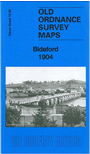
    This detailed map covers most of the north Devon town of Bideford.

    The town centre is covered in detail with individual buildings neatly shown. Features include Town Hall, Bideford Bridge, Bideford Westward Ho & Appledore Light Railway, High Street area, Bideford Union Workhouse, church and chapels, Belvoir area, Handy Cross area, Ford House, River Torridge, Edgehill Bible Christian College, Market House etc. On the east bank of the river the map includes East-the-Water, LSWR railway with station, Chudleigh House, Royal Hotel etc. On the reverse we include a list of inhabitants from a 1906 directory.


  • Follow this link for a list of our maps for Devon county, Plymouth, or Torbay; or here for a general list for the South West.
  • You can order maps direct from our On-line Mapshop. For other information and prices, and other areas, go to The Index Page.
  • Maps in the Godfrey Edition are taken from the 25 inch to the mile map and reduced to about 15 inches to the mile. For a full list of maps for England, return to the England page.
    Alan Godfrey Maps, Prospect Business Park, Leadgate, Consett, Co Durham, DH8 7PW / sales@alangodfreymaps.co.uk / 13 January 2018