Derbyshire Sheet 45.04 Heanor 1913 - published 2018; intro by Barrie Trinder. ISBN.978-1-78721-175-9 
This detailed map gives very good coverage of the Derbyshire town of Heanor.
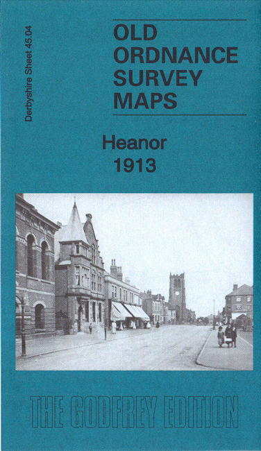
Features include the town centre with individual buildings neatly shown, St Laurence's church, chapels, Hosiery Manufactory, Public Offices,
Common Side area, Technical School, tramway, Heanor Gate area, Loscoe Grange area, Infectious Diseases Hospital, Lace Factory, etc. Three railway lines are shown:
the GNR Heanor Branch with its terminus; Midland Railway Ripley & Heanor Extension with station; and MR Heanor Goods Branch with (at top of map) Bailey Brook Colliery.
The map links up with Notts sheets 37.01 Eastwood West to the east.
This is the first of a new group of maps being published for Derbyshire during 2018-9. A Subscription Offer is available for those wishing to
pre-order the next ten titles.
Follow this link for a list of our maps for Derbyshire.
You can order maps direct from our On-line Mapshop.
For other information and prices, and other areas, go to The Index Page.
Maps in the Godfrey Edition are taken from the 25 inch to the mile map and reduced to about 15 inches to the mile.
For a full list of maps for England, return to the England page.
Alan Godfrey Maps, Prospect Business Park, Leadgate, Consett, Co Durham, DH8 7PW / sales@alangodfreymaps.co.uk / 8 December 2018

 Here are the details of maps for Heanor: