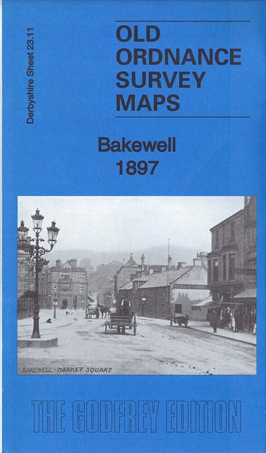
Derbyshire Sheet 23.11 Bakewell 1897 - published 2016; intro by Alan Godfrey. ISBN.978-1-78721-007-3 
This detailed map gives good coverage of Bakewell, the 'Capital of the Peak'.
Features include All Saints church, Bakewell Union Workhouse, Lumford Mill, Ashford Hall (at top of map), Holme Hall, River Wye, Victoria Mill, Higgenholes,
marble works, stretch of railway though station is just off the map, cattle market, town centre with individual buildings neatly shown, Rutland Hotel, Bath Gardens etc.
Extracts from an 1895 trade directory are included on the reverse.
Follow this link for a list of our maps for Derbyshire.
You can order maps direct from our On-line Mapshop.
For other information and prices, and other areas, go to The Index Page.
Maps in the Godfrey Edition are taken from the 25 inch to the mile map and reduced to about 15 inches to the mile.
For a full list of maps for England, return to the England page.
Alan Godfrey Maps, Prospect Business Park, Leadgate, Consett, Co Durham, DH8 7PW / sales@alangodfreymaps.co.uk / 25 November 2016
 Here are the details of maps for Bakewell: