 Here are the details of maps for Coulsdon Common:

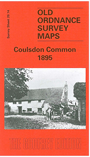
This detailed map covers Coulsdon Common and the area to the east, including Ninhams (where development had just started); Salmons, and the area around Whyteleafe Road; Portley and Portley Wood. The map portrays a semi-rural area of villas in large gardens: Blizewood, Maes Mawr, Bleak House, Portley, Thornbury, Flintfield House, with just the northern tip of Caterham Barracks at the foot of the map. On the reverse we include a section of the 1910 Revision, showing the Ninhams (or Ninehams) estate and Caterham Barracks further developed.
You might find this Index map useful.