Old Ordnance Survey Maps of Cornwall

  • These detailed maps normally cover an area of about one and a half miles by one mile. Each map includes an introduction.
  • They are available through our On-line Mapshop

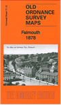
  • Here are the details of maps for Falmouth:

  • Cornwall Sheet 71.12 Falmouth 1878 - published 2012; intro by Richard Oliver. ISBN.978-1-84784-725-6

    This detailed map covers much of Falmouth, with coverage extending from Greenbank Quay southward to Wood Lane, and eastward to Midle Point.

    Features include Cornwall Railway with station, Western and Eastern Breakwaters, Falmouth Hotel, docks, Outer and Inner Harbours, King Charles the Martyr church, Market Place, town centre with individual buildings neatly shown, Wodehouse Terrace, Wellington Terrace, Harbour Terrace, Town Quay, All Saints church, The Moor, Berkeley Vale, hotels etc. A list of private residents from a 1910 directory is included on the reverse.


  • Follow this link for a list of our maps for Cornwall or here for a general list for the South West.
  • You can order maps direct from our On-line Mapshop. For other information and prices, and other areas, go to The Index Page.
  • Maps in the Godfrey Edition are taken from the 25 inch to the mile map and reduced to about 15 inches to the mile. For a full list of maps for England, return to the England page.
    Alan Godfrey Maps, Prospect Business Park, Leadgate, Consett, Co Durham, DH8 7PW / sales@alangodfreymaps.co.uk / 13 January 2018