
 Here are the details of maps for Camborne:

This detailed map covers the important mining town of Camborne.
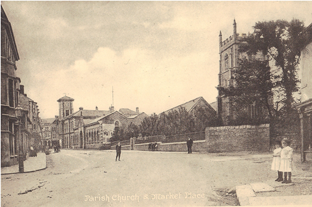
Features include railway with station, part of Roskear Branch, Dolcoath Halt, tramway, Camborne Vean Mine, Rosewarne House, Brass & Iron Foundry, Wheal Gerry Shaft, Pengegon, Pengeon Coombe, Dolcoath Mine, Trevu, Camborne Beacon, Crane, Tregenna Villa, Weeth, Gustavus, town centre with individual houses neatly shown.
 Tony Clifford provides a comprehensive introduction, of which this is a short extract: "By 1841 Camborne was overwhelmingly a
mining town, with over two thirds of the local population employed directly by the mines and this is reflected in
the built environment. The mining activity also attracted related industries such as numerous smithies (75 are recorded in the 1841 census) and small engineering workshops,
including Richard Trevithick's workshop in the grounds of Rosewarne Park, Tehidy Road (now demolished) and Nicholas Holman's high pressure boiler works, founded in 1801.
Nicholas (1777-1862) had four sons who formed a very successful company that became Holman Brothers, subsequently so much a part of the history of the town.
Tony Clifford provides a comprehensive introduction, of which this is a short extract: "By 1841 Camborne was overwhelmingly a
mining town, with over two thirds of the local population employed directly by the mines and this is reflected in
the built environment. The mining activity also attracted related industries such as numerous smithies (75 are recorded in the 1841 census) and small engineering workshops,
including Richard Trevithick's workshop in the grounds of Rosewarne Park, Tehidy Road (now demolished) and Nicholas Holman's high pressure boiler works, founded in 1801.
Nicholas (1777-1862) had four sons who formed a very successful company that became Holman Brothers, subsequently so much a part of the history of the town.
 "At its height Holman's was spread over three sites in Camborne, employing about 3,500 people. The Rock Drill Department was next to the railway station;
rock and pneumatic tools began to be manufactured on a large scale after the First World War. The company expanded
into a huge variety of mining equipment as well as boilers; by 1966, 70 per cent of goods were exported to customers world-wide.
Regrettably recession occurred in the 1970s and early 1980s and the company declined. After a period of mergers and amalgamations,
CompAir closed the factory in 2003, with the loss of many jobs, and concentrated production in Germany. Little now remains of the
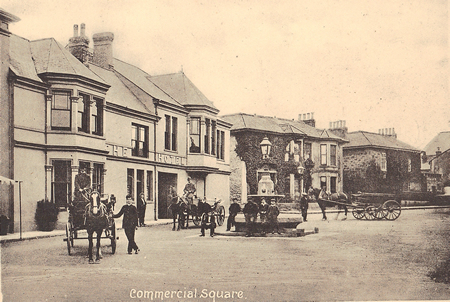
Holman factories which used to dominate the town. The impressive frontage of the engineering works adjacent to the Centenary Chapel
once occupied most of Wesley Street and appear as Brass & Iron Foundry on this map".
"At its height Holman's was spread over three sites in Camborne, employing about 3,500 people. The Rock Drill Department was next to the railway station;
rock and pneumatic tools began to be manufactured on a large scale after the First World War. The company expanded
into a huge variety of mining equipment as well as boilers; by 1966, 70 per cent of goods were exported to customers world-wide.
Regrettably recession occurred in the 1970s and early 1980s and the company declined. After a period of mergers and amalgamations,
CompAir closed the factory in 2003, with the loss of many jobs, and concentrated production in Germany. Little now remains of the
Holman factories which used to dominate the town. The impressive frontage of the engineering works adjacent to the Centenary Chapel
once occupied most of Wesley Street and appear as Brass & Iron Foundry on this map".
The map also includes a list of private residents from a 1910 directory, completing an excellent resource package for all who are interested in the history of Camborne.