 Here are the details of maps for Bishop's Castle & Clun:

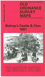
This detailed map is double-sided so that we can give coverage of two of south Shropshire's little towns. Our main map covers Bishop's Castle which, until 1966, could claim to be the smallest municipal borough in England. Until 1832 it returned two Members to Parliament. Between 1865 and 1935 it was the terminus of an especially eccentric railway, linking it with the outside world at Craven Arms. The map covers most of the town, from Castlegreen and the site of the castle southward to St John the Baptist's church and the Old Hall, and beyond them into open country. Features include the workhouse, the terminus of the Bishop's Castle Railway, Church Street, High Street. Beyond the town we find isolated houses, the map going as far as The Hut, Snakescroft, Oakeley Farm. On the reverse is a section of Sheet 69.11, covering the centre of Clun, really a large village rather than town. Features include St George's church, the castle ruins, High Street, Clun Bridge. To complete a valuable local history package, the map includes commercial directories for both towns.