
 Here are the details of maps for Birkenhead and Tranmere waterfront:

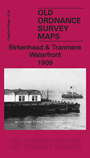
This title includes two maps, sheets 13.04 and 13.08 covering a good stretch of the Birkenhead and Tranmere waterfront.
The maps are busy with riverside activity. Features on the northernmost map include Woodside Station, Woodside Ferry, Woodside Lairage, Clover's Graving Docks, Birkenhead Iron Works, Wallasey Landing Stage, GWR goods station, Wallasey Lairage, Morpeth Branch Dock, CLR goods station, Town Hall, Sessions Court, Monk's Ferry, Carnegie Library, tramways, numerous graving docks,etc.
The southernmost map extends coverage southward to include Tranmere Shipbuilding Yard, Inner and Outer Basin, South End Electricity Generating Station, stretch of LNWR and GWR joint railway, tramways, jam works, Seafield House, etc. There are extracts from an 1896 street directory on the reverse.
The map links up with Cheshire sheet 13.03 Birkenhad to the west, 13.12 Rock Ferry to the south.