Old Ordnance Survey Maps of Cumberland

  • These detailed maps normally cover an area of about one and a half miles by one mile. Each map includes an introduction.
  • They are available through our On-line Mapshop

  • Here are the details of maps for Brampton:

  • Cumberland Sheet 18.05 Brampton 1924 - published 2005; intro by Alan Godfrey. ISBN.978-1-84151-790-2

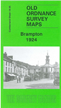
    This detailed map gives good coverage of the small town of Brampton, with coverage extending from Townfoot Farm eastward to Cumcatch.

    Features include the town centre with individual buildings neatly shown, Tweed Mill, Old Brewery, St Martin's Hall, Market Place, Moot Hall, The Mote, New Brewery, St Martin's church, Sands area, cattle market, railway branch with Staith and station site (it had closed in 1923), Catgallows Hill, Howgate, Warren House etc. On the reverse we include extracts from a 1901 directory for Brampton.


  • Follow this link for a complete list of our Cumberland Series maps.
  • You can order maps direct from our On-line Mapshop. For other information and prices, and other areas, go to The Index Page.
  • Maps in the Godfrey Edition are taken from the 25 inch to the mile map and reduced to about 15 inches to the mile. For a full list of maps for England, return to the England page.
    Alan Godfrey Maps, Prospect Business Park, Leadgate, Consett, Co Durham, DH8 7PW / sales@alangodfreymaps.co.uk / 8 January 2018