Sheet 30.16 Soham 1901 - published 2014; intro by Tony Kirby. ISBN.978-1-84784-839-0 
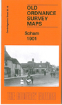
This detailed map gives good coverage of the small Cambridgeshire town of Soham, from Julius Martin's Lane southward to Mill Croft..
Features include railway with station, East Fen Common, The Beeches, windmills, The Red House, St Andrew's church, The Place, Town Hall,
brewery, Burgess Corner, Burry Crofts Field, Soham Mills, The Moat, Red Lion Square, chapels, St Etheldreda's Room, Angle Farm, Horse Bridge, Soham Lode,
Mere Side, etc.
Follow this link for a complete list of our Cambridgeshire maps.
You can order maps direct from our On-line Mapshop.
For other information and prices, and other areas, go to The Index Page.
Maps in the Godfrey Edition are taken from the 25 inch to the mile map and reduced to about 15 inches to the mile.
For a full list of maps for England, return to the England page.
Alan Godfrey Maps, Prospect Business Park, Leadgate, Consett, Co Durham, DH8 7PW / sales@alangodfreymaps.co.uk / 25 November 2017

 Here are the details of maps for Soham: