 Here are the details of maps for Tremadoc:

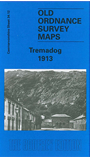
This detailed map covers the village of Tremadog (or Tremadoc) with coverage extending southward to Portmadoc station and eastward to Portreuddyn Castle (on north margin of map).
Features include Tremadog village centre with individual buildings neatly shown, Market Square, Madoc Tannery, Tan-yr-allt Mill, Craig Pant-Ifan, Craig Bwlch-y-moch, Pen-syflog, stretch of Cambrian Railway with Portmadoc station, stretch of Croesor Tramway with Beddgelert Siding, County Intermediate School etc. On the reverse we include a short directory of Tremadoc, plus railway timetables for the Cambrian and Welsh Highland railways in 1929.
The map links up with sheet 34.16 Porthmadog to the south.