
 Here are the details of maps for Bishop's Stortford:

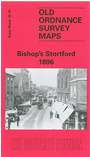
Yes, we know Bishop's Stortford is a Hertfordshire town, but the sheetlines in the Essex Series covered the town more neatly, and so we have reprinted that sheet. This detailed map covers the bulk of the town, and coverage extends west along the Hadham Road as far as Stort Lodge, north to Barrelsdown Road and east to Stortford Hall and the workhouse. The town centre is included and features include the station, Hockerill, Windhill House, New Town, The Chantry, All Saints church, Diocesan Training Institute for Schoolmistresses, remains of Waytemore Castle. Wharf House, Stort Navigation, Hockerill Cut, numerous malthouses, Collins Cross, cemetery. A contemporary directory in included.
Maps in the Godfrey Edition are taken from the 25 inch to the mile map and reduced to about 15 inches to the mile. For a full list of maps for England, return to the England page.
Alan Godfrey Maps, Prospect Business Park, Leadgate, Consett, Co Durham, DH8 7PW / sales@alangodfreymaps.co.uk / 25 November 2017