
 Here are the details of maps for Newton upon Ayr:

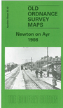
This detailed map covers Newton upon Ayr, north of Ayr itself. Coverage extends from Viewfield Road northward to Marchfield Road. Features include Newton Carpet Works, Newton Park, Heathfield Hospital, Ayr Wet Dock with Euchar Rock, Hawkhill Chemical Works, tramway and depot; railways with Falkland Junction, engine depot, Blackhouse Junction, Newton Junction, station, Ayr Harbour Branch; St Crispin Works, Tweed Mills, Falkland House, chemical works etc. On the reverse we include a selection of street directory entries, including Campbell Street, Falkland Park Road, McCall's Avenue, Preswtick Road, West Sanquhar Road.
The map links up with Ayrshire sheet 27.14 Prestwick to the north and 33.06 Ayr to the south.