Old Ordnance Survey Maps of Ayrshire

  • These detailed maps normally cover an area of about one and a half miles by one mile. Each map includes an introduction.
  • They are available through our On-line Mapshop

  • Here are the details of maps for Ardrossan (South):

  • Ayrshire Sheet 16.05 Ardrossan (South) 1895 - published 2009; intro by Gilbert Bell. ISBN.978-1-84784-291-6

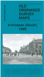
    This detailed map covers the southern part of Ardrossan, including much of the town centre. Features include the southern part of Glasgow Street, Eglinton Dock, Old Dock, Tidal Basins, Montgomerie Pier station, Winton Pier station, SWouth Beach station, GSWR railway and main station, Castle Hill, South Beach, St Andrew's church, Gaelic church, Crinan Rock, etc. We include a selection of trade directory entries on the reverse.

    The map links up with Ayrshire sheet 16.01 Ardrossan North to the north and 16.06 Saltcoats to the east.


  • Follow this link for a complete list of our Ayrshire maps.
  • You can order maps direct from our On-line Mapshop. For other information and prices, and other areas, go to The Index Page.
  • Maps in the Godfrey Edition are taken from the 25 inch to the mile map and reduced to about 15 inches to the mile. For a full list of maps for Scotland, return to the Scotland page.
    The Godfrey Edition / sales@alangodfreymaps.co.uk / 15 November 2016