Old Ordnance Survey Maps of Buckinghamshire

  • These detailed maps normally cover an area of about one and a half miles by one mile. Each map includes an introduction.
  • They are available through our On-line Mapshop

  • Here are the details of maps for Aylesbury:

  • Buckinghamshire Sheet 28.16 Aylesbury 1923 - published 1993; intro by Julian Hunt. ISBN.978-0-85054-622-4

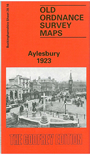
    This detailed map is double-sided to provide maximum coverage. The main map covers the eastern part of the town, from Market Square and Kingsbury eastward to Victoria Park and the edge of town. Features include Walton, High Street, LMS terminus, Grand Junction Canal, Town Hall, Walton Street, Walton Brewery, Walton Mill, Cattle market, cemetery. On the reverse is more than half of sheet 28.15, extending coverage westward; features here include GWR / Metropolitan station, Temple Square, St Mary's church, Church Street, Buckingham Street, Castle Street, Royal Buckinghamshire Hospital. In the 1920s Aylesbury was still a small market town of 12,114 people and this captures it before its post-war growth.


  • Follow this link for a complete list of our Buckinghamshire or Milton Keynes maps.
  • You can order maps direct from our On-line Mapshop. For other information and prices, and other areas, go to The Index Page.
  • Most maps in the Godfrey Edition are taken from the 25 inch to the mile map and reduced to about 15 inches to the mile. For a full list of maps for the Buckinghamshire region, return to the Thames & Chilterns page
    The Godfrey Edition / sales@alangodfreymaps.co.uk / 27 January 2018