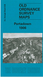
 Here are the details of maps for Portadown:

This detailed map of Portadown is double-sided for maximum coverage.
The main map covers the centre of the town, with coverage stretching from the Bann Bridge southward to Annagh Terrace. Features include railway junction and engine depot, Market Street, St Mark's church, bacon factory, weaving factories, Tavanagh Factory, Annagh Factory, High Street area, rope works, Pork Market, Corcrain area incl Corcrain House and Corcrain Villa, Fair Green, part of Clownagh area incl Clownagh Cottage, Tavanagh area incl Tavanagh House, River Bann, etc.
On the reverse we include part of adjacent sheet 9.04 extending coverage north; this includes Garvaghy area, People's Park, Castle Island Factory, Bannview Factory, Parkside Damask Factory, railway station (then on east of river), Edenderry Weaving Factory, Eden Hall, St Joseph's RC Church, Woodside Nursery, Corcrain School.