Old Ordnance Survey Maps of Argyllshire

  • These detailed maps normally cover an area of about one and a half miles by one mile. Each map includes an introduction.
  • They are available through our On-line Mapshop

  • Here are the details of maps for Oban:

  • Argyllshire Sheet 98.07 Oban 1898 - published 2008; intro by Gilbert Bell. ISBN.978-1-84784-133-9

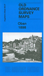
    This very detailed map is double-sided for maximum coverage. The main map covers most of the town centre, with coverage extending from Barr Cruinn southward to Loch a Mhuilinn, and inland to the unfinished Hydropathic. Features include station, goods station, Railway Quay, North Pier, South Pier, Manor House, St Columba's RC Pro Cathedral, Royal Hotel, numerous other hotels named, churches etc. This map is most unusual in being contoured. On the reverse we include a part of adjacent sheet 98.11, extending coverage south, including Glenmore Wood, Altnacraig, McKelvie Isolation Hospital, Soroba Farm, High School.


  • Follow this link for a complete list of our Argyll & Bute maps.
  • You can order maps direct from our On-line Mapshop. For other information and prices, and other areas, go to The Index Page.
  • Maps in the Godfrey Edition are taken from the 25 inch to the mile map and reduced to about 15 inches to the mile. For a full list of maps for Scotland, return to the Scotland page.
    The Godfrey Edition / sales@alangodfreymaps.co.uk / 15 November 2016