 Here are the details of maps for Aberdeen (N):

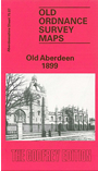
This detailed map covers the north part of Aberdeen, with coverage stretching from Stafford Street northward to Kettle Hill, and from Laurelwood Avenue eastward to Broad Hill and the King's Links.
Features include the Old Aberdeen area, St Peter's Cemetery, Trinity Cemetery, King's College, St Machar's Hall, Militia Barracks, Chanonry area, Pittodrie Park, Aberdeen Jute Works, Powis House, Belmont Auction Mart, railway with locomotive works, goods line, Kittybrewster station, Mitchell's Hospital etc. On the reverse we include a selection of street directory entries, including Great Northern Road, High Street, Jamaica Street, Leslie Terrace, Powis Place/Terrace, Spital.
The map links up with Aberdeenshire sheet 75.03 Bridge of Don to the north, 75.11 Aberdeen to the south.